![](/images/other/stat-length.png)
![Randonnée La Roche-en-Ardenne - 2021-11-22_21h56m12_1637613700298_Cirkwi-La_Roche-en-Ardenne_-__Promenade_Cielle_ - Photo](https://media.geolcdn.com/t/1900/400/ext.pjpeg?maxdim=2&url=https%3A%2F%2Fsecurestorage.geolives.com%2Fsitytour%2Ftrail-bg%2Fdefault.jpg)
2021-11-22_21h56m12_1637613700298_Cirkwi-La_Roche-en-Ardenne_-__Promenade_Cielle_
anjodena
Utilisateur
![Longueur](/images/other/stat-length.png)
![Altitude max](https://static1.geolcdn.com/siteimages/upload/files/1508320355ic_sort_altitude_max_24dp.png)
![Dénivelé positif](https://static1.geolcdn.com/siteimages/upload/files/1508320355ic_sort_den_pos_24dp.png)
![Km-Effort](/images/other/stat-length.png)
![Altitude min](https://static1.geolcdn.com/siteimages/upload/files/1508320355ic_sort_altitude_min_24dp.png)
![Dénivelé négatif](https://static1.geolcdn.com/siteimages/upload/files/1508320355ic_sort_den_neg_24dp.png)
![Boucle](https://static1.geolcdn.com/siteimages/upload/files/16400158638029165_repeat_loop_refresh_sync_direction_icon.png)
![Scannez ce code QR pour ouvrir la randonnée dans l'application SityTrail](https://capi.geolives.com/qq0zvz2zws4bq2lad0pu/sitytour/trails/3010281/qr.png?size=200)
Application GPS de randonnée GRATUITE
À propos
Randonnée de 9 km à découvrir à Wallonie, Luxembourg, La Roche-en-Ardenne. Cette randonnée est proposée par anjodena.
Description
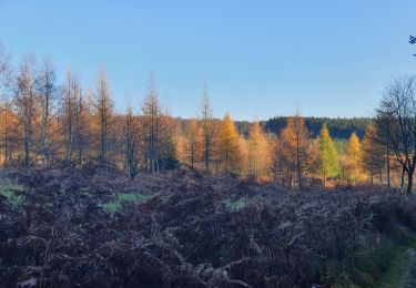
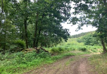
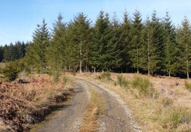
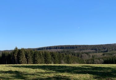
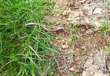
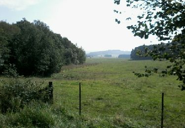
Balisage: Losange rouge n°1 Au départ de la Maison du Tourisme à La Roche-en-Ardenne, la promenade vous emmène vers la carrière en activité de Cielle. Vous poursuivez vers le joli village de Cielle, sur les hauteurs rochoises. Le retour vers le centre de La Roche s'effectue par la croix de Cielle et la rue Gohette. Cette promenade fait partie de la carte pédestres de La Roche-en-Ardenne. Pour commander cette carte, cliquer sur le lien suivant: http://marando.be/catalog/index/view/id/167/lang/fr
Localisation
Commentaires
Randonnées à proximité
![Randonnée Marche La Roche-en-Ardenne - RB-Lu-05_La-Roche-en-Ardenne - Photo](https://media.geolcdn.com/t/375/260/ext.jpg?maxdim=2&url=https%3A%2F%2Fservices.sitytrail.com%2FGeolivesWS%2FDownloadMedia.ashx%3FTrailID%3D179614%26Media%3Ddb2598db-79d7-4bc8-afb7-55d65e443283.jpg)
![Marche Marche](https://static1.geolcdn.com/sitytour/trail-icons/101.png)
Marche
![](/images/other/stat-length.png)
![](https://static1.geolcdn.com/siteimages/upload/files/16400158638029165_repeat_loop_refresh_sync_direction_icon.png)
![Randonnée Marche La Roche-en-Ardenne - rando samrée 26/11/2020 - Photo](https://media.geolcdn.com/t/375/260/b9b92636-327b-470f-9fef-3742386ec0a6.jpg&format=jpg&maxdim=2)
![Marche Marche](https://static1.geolcdn.com/sitytour/trail-icons/101.png)
Marche
![](/images/other/stat-length.png)
![](https://static1.geolcdn.com/siteimages/upload/files/16400158638029165_repeat_loop_refresh_sync_direction_icon.png)
![Randonnée Marche La Roche-en-Ardenne - Samree-maboge-Samree - Photo](https://media.geolcdn.com/t/375/260/b1140dd6-ef3b-4be2-9da7-c3279afff05d.jpeg&format=jpg&maxdim=2)
![Marche Marche](https://static1.geolcdn.com/sitytour/trail-icons/101.png)
Marche
![](/images/other/stat-length.png)
![](https://static1.geolcdn.com/siteimages/upload/files/16400158638029165_repeat_loop_refresh_sync_direction_icon.png)
![Randonnée Marche La Roche-en-Ardenne - Balade à Samrée - Photo](https://media.geolcdn.com/t/375/260/8ac758ba-e05d-40e0-9a71-4c66a47c27c2.jpg&format=jpg&maxdim=2)
![Marche Marche](https://static1.geolcdn.com/sitytour/trail-icons/101.png)
Marche
![](/images/other/stat-length.png)
![](https://static1.geolcdn.com/siteimages/upload/files/16400158638029165_repeat_loop_refresh_sync_direction_icon.png)
![Randonnée Marche La Roche-en-Ardenne - Celtes et Ourthe - Photo](https://media.geolcdn.com/t/375/260/ext.jpg?maxdim=2&url=https%3A%2F%2Fservices.sitytrail.com%2FGeolivesWS%2FDownloadMedia.ashx%3FTrailID%3D854402%26Media%3Dfix__20171030123801.jpg)
![Marche Marche](https://static1.geolcdn.com/sitytour/trail-icons/101.png)
Marche
![](/images/other/stat-length.png)
![](https://static1.geolcdn.com/siteimages/upload/files/16400158638029165_repeat_loop_refresh_sync_direction_icon.png)
![Randonnée Marche La Roche-en-Ardenne - Un petit tour dans les fagnes de la goutte en partant de Samree - Photo](https://media.geolcdn.com/t/375/260/faa437e4-187a-4ff0-9cbb-6255b11e3348.jpg&format=jpg&maxdim=2)
![Marche Marche](https://static1.geolcdn.com/sitytour/trail-icons/101.png)
Marche
![](/images/other/stat-length.png)
![](https://static1.geolcdn.com/siteimages/upload/files/16400158638029165_repeat_loop_refresh_sync_direction_icon.png)
![Randonnée Marche La Roche-en-Ardenne - très belle - Photo](https://media.geolcdn.com/t/375/260/20ac222d-4563-44a0-a49e-63d4fb5a1b07.jpg&format=jpg&maxdim=2)
![Marche Marche](https://static1.geolcdn.com/sitytour/trail-icons/101.png)
Marche
![](/images/other/stat-length.png)
![](https://static1.geolcdn.com/siteimages/upload/files/16400158638029165_repeat_loop_refresh_sync_direction_icon.png)
![Randonnée Marche La Roche-en-Ardenne - buisson - nagimont - Ortho - Photo](https://media.geolcdn.com/t/375/260/ext.jpg?maxdim=2&url=https%3A%2F%2Fservices.sitytrail.com%2FGeolivesWS%2FDownloadMedia.ashx%3FTrailID%3D343702%26Media%3Dfix__20140909123303.jpg)
![Marche Marche](https://static1.geolcdn.com/sitytour/trail-icons/101.png)
Marche
![](/images/other/stat-length.png)
![](https://static1.geolcdn.com/siteimages/upload/files/16400158638029165_repeat_loop_refresh_sync_direction_icon.png)
![Randonnée Marche Rendeux - Montaigu - Photo](https://media.geolcdn.com/t/375/260/ext.jpg?maxdim=2&url=https%3A%2F%2Fservices.sitytrail.com%2FGeolivesWS%2FDownloadMedia.ashx%3FTrailID%3D264121%26Media%3De6783db9-1bdf-46f4-876d-878e9e4b81fa.jpg)
![Marche Marche](https://static1.geolcdn.com/sitytour/trail-icons/101.png)